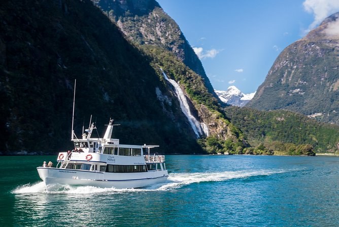
Cruise Milford NZ Small Boutique Cruise Experience
A boutique cruise of 1 hour 45 minutes with coffee, tea and biscuits on every sailing. No food is sold on board, and the car park is paid by card.
From $110 per person
Check AvailabilityMilford Sound is a village at the end of a long road, a terminal on the water and a fiord that runs out to the Tasman Sea. Here is where everything is, from the car park to the fiord's mouth, and where each of the Milford Sound NZ tours begins.
The fiord lies in the north-west of Fiordland National Park and runs about 15 km from the village to the open sea. The Milford Sound Visitor Terminal sits at its head, on Freshwater Basin. The mouth is marked by St Anne Point lighthouse and Dale Point.
Six places matter for your visit. You will pass or use most of them in a single day.
The village is small, and everything is within walking distance. The paid car park is the closest to the terminal. Deepwater Basin, the free car park, is further out. The airstrip sits between them, about ten minutes' walk from the terminal.
| Place | What it is for | Walk to the terminal |
|---|---|---|
| The Visitor Terminal | Check-in for every day cruise | You are there |
| Main car park | Paid parking, NZ$10 an hour | About 10 minutes |
| Deepwater Basin | Free parking; the track water taxi | About 40 minutes |
| The airstrip | Flights and helicopters | About 10 minutes |
| Public toilets | At the fiord; none on the road after Knobs Flat | In the village |
If you are catching a cruise, park in the main car park unless you have an hour to spare. The full parking rules and the check-in desks are in the visitor guide.
Inside the terminal, each cruise company has its own desk, and your booking names it. Cruise Milford's counter is the second on the left, and Pure Milford's desk is on the right-hand side. Check in at your own desk, and you will be sent to the right boat at the wharf.
Deepwater Basin is worth knowing even if you park near the terminal. The water taxi for the track day walk leaves from 75 Deepwater Basin Road, beside the free car park. Leave time for the drive or the walk between the two.
Every day cruise follows the same line: out from the terminal to the Tasman Sea and back. The skipper names the points as you pass. This is the route in the order you meet it.
Along the northern side you are sailing over the Piopiotahi Marine Reserve, which runs from the village to Dale Point. The overnight boats sail the same route in the late afternoon and anchor for the night, so you see the fiord after the day boats have gone.
The Milford Road is the only road in. It runs about 120 km from Te Anau to the fiord, and DOC gives the distance to each walk from Te Anau. Use them to plan your stops if you drive.
| Stop | Distance from Te Anau |
|---|---|
| Mirror Lakes | About 56 km |
| Lake Gunn, at Cascade Creek | About 78 km |
| The Chasm | About 109 km |
| The fiord | About 120 km |
The Homer Tunnel sits between Lake Gunn and The Chasm, at the top of the road. The Chasm is about halfway between the tunnel and the fiord. The full stop-by-stop guide is on the road page.
Your tour may start far from the fiord. The road days collect you in Queenstown or Te Anau. The cruises, the track walk and the flights from the fiord start in the village itself.
| Where the day starts | What starts there |
|---|---|
| Queenstown | Road days, fly-cruise-fly days and the helicopter-and-cruise day |
| Te Anau | Road days that are shorter by about half the driving |
| The Visitor Terminal | Every day cruise and both overnight cruises |
| Deepwater Basin | The water taxi for the track day walk |
| The airstrip | The helicopter flight and the one-way flight out |
In Queenstown, pickups include The Station, on Shotover and Camp Streets, and many hotels. In Te Anau, one coach checks in at 80 Lakefront Drive, and the vans collect you from your hotel.
Milford Sound, Fiordland, New Zealand
The
terminal, the car parks, the airstrip and the fiord
The map loads from Google only when you press the button. The terminal is at the head of the fiord, and the fiord runs north-west to the sea.
You will lose phone signal past Te Anau, so take these with you on paper or offline.
Road distances, the reserve's extent and the track's end are DOC's, checked 21 September 2026. Walking times around the village, the cruise route and the meeting points come from the operators' own booking pages, captured the same day.
A boutique cruise of 1 hour 45 minutes with coffee, tea and biscuits on every sailing. No food is sold on board, and the car park is paid by card.
From $110 per person
Check Availability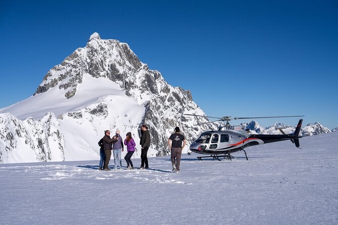
A 45-minute helicopter flight from the fiord's airstrip, six seats at most, with a snow landing when the weather allows. Landing fees are in the fare.
From $523 per person
Check Availability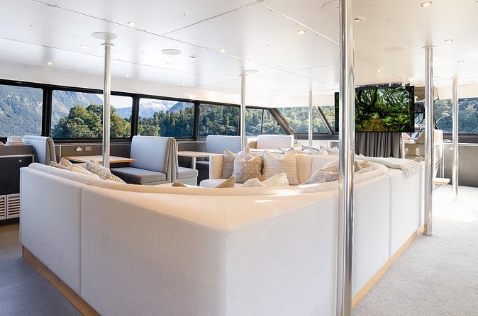
A night on the fiord for up to 22: dinner, breakfast, kayaking, a tender-boat trip and a top-deck hot tub. Non-refundable, minimum two.
From $847 per person (minimum 2)
Check AvailabilityNext: see how to get there, check the weather, or compare every tour on Milford Sound Tours.